IMAGYN project
Management information
Project description
High-resolution imaging of the crustal-scale structure of the Central Pyrenees and role of Variscan inheritance on its geodynamic evolution.
The main objective of the IMAGYN project is to obtain a high-resolution image of the crustal structure of the Central Pyrenees through the integration of geological and geophysical data obtained from several methods.
This image is necessary to analyze the role played by Variscan structures and the petrophysical and structural heterogeneity in the geodynamic evolution of the orogen. The project has two main objectives:
(i) to deepen in areas of special interest in the Central Pyrenees by integrating new geophysical data to reduce existing uncertainties, and
(ii) to characterize the upper and lower crust of the Central Pyrenees and to extend the study area to the Ebro and Aquitaine foreland basins.
To this image of the current configuration of the orogen will be added the kinematic and flow direction characterization of the Permo-Carboniferous volcanoclastic materials of the Erill Castell-Estac basin.
The comparison with previous data from the Cadí basin will allow us to analyze the pre-Alpine configuration of these basins and to reconstruct their geodynamic evolution together with the associated granitic bodies.
Targets
To improve our knowledge of the current structure and geometry in depth of the Central Pyrenees, as a fundamental basis for understanding the role played by the Variscan heritage in its geodynamic evolution.
Activities
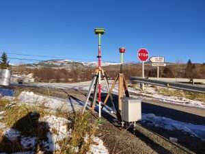
Gravimeter and GPS station belonging to the IGME-CSIC.
The acquisition of gravity data for subsequent interpretation and integration with geological data constitutes one of the Activities of the IMAGYN project.
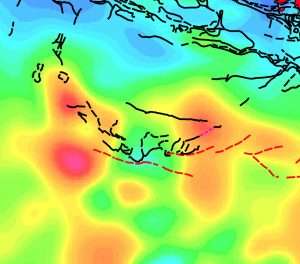
Magnetic anomaly map.
The interpretation of magnetic data and their integration with geological data constitutes one of the Activities of the IMAGYN project.
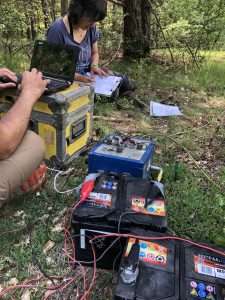
Magnetotelluric data adquisition.
The acquisition and interpretation of magnetotelluric (MT) data in the study area constitutes one of the Activities of the IMAGYN project.
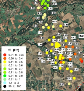
Passive seismic data adquisition and interpretation.
The acquisition and interpretation of passive seismic data in the study area constitutes one of the Activities of the IMAGYN project.
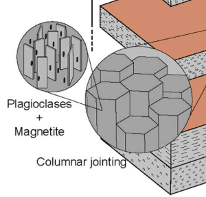
Adquisition and interpretation of Anisotropy of Magnetic Susceptibility (AMS).
The acquisition and interpretation of Anisotropy of Magnetic Susceptibility (AMS) data in Permo-Carboniferous rocks from the study area constitutes one of the Activities of the IMAGYN project.
Integration of results.
The final objective is to obtain a high-resolution crustal and lithospheric image of the Central Pyrenees from the integration of geological and geophysical data.
Team
Collaborators
Involved groups
Publications
Related video gallery
Collaborating institutions
© 2024 Instituto Geológico y Minero de España


