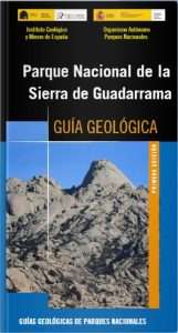
Sierra de Guadarrama National Park
The Sierra de Guadarrama, nestled in the Central System, is part of the natural division between the northern and southern plateaus. The rocks that form the substrate of the Sierra de Guadarrama National Park underwent deformation and metamorphism towards the end of the Paleozoic in the tectonic process that led to the formation of a great mountain range, the Varisca Mountain Range, formed by the collision of the paleo continents. Gondwana and Laurusia. The original rocks were transformed mineralogically, originating metamorphic rocks such as gneisses and schists. In many cases, they even melted, causing magmas that, once cooled, constitute the granitic rocks we can see today in places like La Pedriza. During the Mesozoic, intense erosion completely dismantled the mountain range. The territory of what is now the Sierra de Guadarrama was first crossed by large rivers and then intermittently occupied by the sea in a tropical environment. During the Cenozoic, the compression of the crust produced during the Alpine Orogeny, by the collision of the Iberian and European plates first and with the African plate later, produced the uplift of the mountainous block of what is now the Sierra de Guadarrama. Finally, the erosion and weathering processes of a glacial, periglacial and fluvial type that have acted throughout the Quaternary have finished configuring the current relief.
The Sierra de Guadarrama National Park Guide describes the granitic and metamorphic rocks of the rocky substratum in which geological processes that have taken place in the past at great depths "frozen" in time can be observed, being an excellent museum and natural geological laboratory. It also describes the spectacular granite morphology of ¨La Pedriza del Manzanares¨ which, with its whimsical shapes, constitutes a singular granite complex or that of the Peñalara massif, which stands out for its well-preserved glacial modelling, with numerous lagoons such as those of Peñalara or birds. This guide includes twelve geological itineraries, where the geological units and the geological processes observed in each are described understandably. Finally, the guide includes an appendix with the most relevant bibliography and a glossary with the geological terms used in the text. The guide is accompanied by a Geological Map in which the different geological units with significance in the geological evolution of the territory are represented and a Map of Geomorphological Units where the different types of relief forms that make up the natural landscape are defined.
Information of interes
Authors
L.R. Rodríguez Fernández;F. López Olmedo;L. González Menéndez;F. Rubio Pascual

