Manual de Datos InSARlab
VERSIÓN IMPRESIÓN (Alta resolución - Pdf)
VERSIÓN WEB (Baja resolución - Pdf)
El laboratorio de radar y de modelización de riesgos geológicos representa un grupo multidisciplinar de investigación, desarrollo e innovación promovido por el Instituto Geológico y Minero de España (IGME), en el que participan distintos centros de investigación, universidades y empresas del ámbito nacional e internacional. La integración de datos de desplazamiento de la superficie de la Tierra obtenidos a partir de imágenes satélite radar, con capas geo-temáticas, observaciones in situ y modelos numéricos, nos permite avanzar en el conocimiento de los mecanismos que controlan los terremotos, deslizamientos, y la subsidencia, cuantificar su peligrosidad y evaluar el riesgo. A partir de estos resultados desarrollamos nuevos productos y servicios que mejoran las capacidades de prevención, respuesta y mitigación de los organismos responsables de la gestión y planificación del territorio.
The Geohazards InSAR laboratory and Modelling Group represents a multi-disciplinary innovation, research and development group promoted by the Geological Survey of Spain (IGME), involving research centers, public organisms and companies worldwide. We aim to combine radar satellite observations of Earth’s surface displacements, with geo-thematic layers, in situ observations and modeling to advance the understanding of the mechanisms that control earthquakes, landslides and subsidence, quantifying hazards and evaluating the risk. New services and products are also developed to improve the preparedness, mitigation and response strategies of the organisms responsible for the territorial management and planning.
Download our last article published in Science on Global subsidence
Navigate through the susceptibility and hazard maps Global subsidence map

Proyectos

Proyecto Services supporting the European Environment Agency’s (EEA) implementation of the Copernicus European Ground Motion Service – product validation
2022 – 2026
Investigadora principal IGME: Marta Béjar Pizarro

Proyecto UNDERGY
2022-2024
Investigadora principal IGME: Carolina Guardiola Albert

Proyecto SARAI
2021-2024
Investigadoras principales IGME: Carolina Guardiola, Marta Béjar Pizarro

Proyecto RESERVOIR
2020-2024
Investigadora principal IGME: Carolina Guardiola Albert

Proyecto RASTOOL
2022-2024
Investigadora principal IGME: Marta Béjar Pizarro
Proyecto RISKCOAST
2019-2022
Investigadora principal IGME: Rosa María Mateos

Proyecto E-SHAPE
2019 - 2023
Investigadores principales IGME: Gerardo Herrera, Marta Béjar Pizarro

Proyecto U-Geohaz
2018 - 2020
Investigador principal: Oriol Monserrat

Proyecto GEO-CRADLE
2016 - 2019
Investigador principal: Haris Kontoes

Proyecto SAFETY
2016 - 2018
Investigador principal: Oriol Monserrat

Proyecto PROTHEGO
2015 - 2018
Investigador principal: Claudio Margottini
Proyecto AQUARISK
2014 - 2016
Investigadores principales IGME: José A. Fernández Merodo y Gerardo Herrera

Proyecto LAMPRE FP7
2013 - 2015
Investigador principal: Fausto Guzzetti

Proyecto PANGEO FP7
2011 – 2014
Investigador principal: Ren Carpes

Proyecto DORIS FP7
2010 - 2013
Investigador principal: Fausto Guzzetti
Proyecto INTERREG IV DO-SMS
2009 - 2012
Investigador principal: Jose Darrozes

Proyecto ESA Y GMES Terrafirma
2005 - 2012
Investigador principal: Ren Carpes & Geraint Cooksley
Proyecto GALAHAD FP6
2005 - 2008
Investigador principal: Giorgio Franchioni
Equipo
Miembros
|
Gerardo Herrera Área Riesgos Geológicos Departamento de Investigación y Prospectiva Geocientífica Instituto Geológico y Minero de España |
 |
|
Marta Béjar Pizarro Área Riesgos Geológicos Departamento de Investigación y Prospectiva Geocientífica Instituto Geológico y Minero de España |
 |
|
Rosa María Mateos Ruiz Área Riesgos Geológicos Departamento de Investigación y Prospectiva Geocientífica Instituto Geológico y Minero de España (Unidad de Granada) |
 |
|
José Antonio Fernández Merodo Área Riesgos Geológicos Departamento de Investigación y Prospectiva Geocientífica Instituto Geológico y Minero de España |
 |
|
Juan Carlos García López-Davalillo Área Riesgos Geológicos Departamento de Investigación y Prospectiva Geocientífica Instituto Geológico y Minero de España |
 |
|
Pablo Ezquerro Área Riesgos Geológicos Departamento de Investigación y Prospectiva Geocientífica Instituto Geológico y Minero de España |
 |
|
Roberto Sarro Área Riesgos Geológicos Departamento de Investigación y Prospectiva Geocientífica Instituto Geológico y Minero de España |
 |
|
Joaquín Mulas de la Peña Área Riesgos Geológicos Departamento de Investigación y Prospectiva Geocientífica Instituto Geológico y Minero de España |
 |
|
Juan López Vinielles Área Riesgos Geológicos Departamento de Investigación y Prospectiva Geocientífica Instituto Geológico y Minero de España |
 |
|
Cristina Reyes Carmona Área Riesgos Geológicos (Unidad de Granada) Departamento de Investigación y Prospectiva Geocientífica Instituto Geológico y Minero de España |
 |
|
Guadalupe Bru Departamento de Observación de la Tierra Riesgos Geológicos y Cambio Climático (GI-OBTIER) Instituto Geológico y Minero de España (CN IGME-CSIC) |
 |
Colaboradores IGME
|
Mario Hernández Ruiz Área Riesgos Geológicos Departamento de Investigación y Prospectiva Geocientífica Instituto Geológico y Minero de España |
|
|
Carolina Guardiola Albert Área de Geología Ambiental y Geomatemáticas Departamento de Investigación en Recursos Geológicos Instituto Geológico y Minero de España |
 |
|
Margarita Sanabria Pabón Área de sistemas de información geocientífica y bases de datos institucionales Departamento de infraestructura geocientífica y servicios Instituto Geológico y Minero de España |
|
|
Ángel Prieto Martín Área de sistemas de información geocientífica y bases de datos institucionales Departamento de infraestructura geocientífica y servicios Instituto Geológico y Minero de España |
|
|
Carlos Lorenzo Carnicero Área de sistemas de información geocientífica y bases de datos institucionales Departamento de infraestructura geocientífica y servicios Instituto Geológico y Minero de España |
|
|
Raúl Pérez López Área Riesgos Geológicos Departamento de Investigación y Prospectiva Geocientífica Instituto Geológico y Minero de España |
|
|
Ramón Aragón Rueda Área Riesgos Geológicos Departamento de Investigación y Prospectiva Geocientífica Instituto Geológico y Minero de España (Unidad de Murcia) |
|
|
Mª Teresa López Bahut Área de Geofísica y Teledetección Departamento de Investigación en Recursos Geológicos Instituto Geológico y Minero de España |
|
|
Virginia Rodríguez Gómez Área de Geoquímica y Sostenibilidad Minera Departamento de Investigación en Recursos Geológicos Instituto Geológico y Minero de España |
|
|
Francisco Javier Fernández Naranjo Área de Geoquímica y Sostenibilidad Minera Departamento de Investigación en Recursos Geológicos Instituto Geológico y Minero de España |
|
|
José Antonio Domínguez Sánchez Área de Hidrogeología General y Calidad del Agua Instituto Geológico y Minero de España |
|
|
Francisco J. Roldán García Área Riesgos Geológicos Departamento de Investigación y Prospectiva Geocientífica Instituto Geológico y Minero de España (Unidad de Granada) |
Colaboradores Externos
|
Paolo Allasia Geohazard Monitoring Group Research Institute for Hydrogeological Prevention and Protection Italian National Research Council |
 |
|
Jose Miguel Azañón Hernández Dpto. de Geodinámica Inst. Andaluz de Ciencias de la Tierra Universidad de Granada |
 |
|
Anna Barra Departamento de Teledetección/División de Geomática Centro Tecnológico de Telecomunicaciones de Cataluña (CTTC) |
 |
|
Silvia Bianchini Earth Sciences Department University of Firenze |
 |
|
Roberta Bonì Department of Earth and Environmental Sciences University of Pavia |
 |
|
Elisabeth Díaz Losada GEOSENDA |
 |
|
Javier Duro DARES TECHNOLOGY |
 |
|
José Fernández Torres Instituto de Geociencias (IGEO) CSIC-UCM |
 |
|
Jorge Pedro Galve Arnedo Departamento de Geodinámica Universidad de Granada |
 |
|
Inmaculada García Moreno |
 [+ Información]
 |
|
María Jiménez Mejías Centro Geofísico de Canarias Instituto Geográfico Nacional |
 |
|
Andrea Manconi Dep. of Earth Sciences ETH Zürich |
 |
|
Oriol Monserrat Departamento de Teledetección/División de Geomática Centro Tecnológico de Telecomunicaciones de Cataluña (CTTC) |
 |
|
Davide Notti Istituto di Ricerca per la Protezione Idrogeologica Italian National Research Council (CNR) |
 |
|
José Luis Pastor Área de Ingeniería del Terreno Departamento de Ingeniería Civil Universidad de Alicante |
 |
|
Maria Przyłucka Polish Geological Institute |
 |
|
Paola Reichenbach Institute for Geo-Hydrological Protection Italian National Research Council (CNR) |
|
|
Adrián Riquelme Guill Área de Ingeniería del Terreno Departamento de Ingeniería Civil Universidad de Alicante |
 |
|
Lorenzo Solari Earth Sciences Department University of Firenze |
 |
|
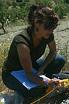
Alejandra Staller Dpto. Ingeniería Topográfica y Cartografía ETSI Topografía, Geodesia y Cartografía Universidad Politécnica de Madrid |
 |
|
Serena Tessitore Department of Civil, Architectural and Environmental Engineering University of Naples Federico II |
 |
|
Roberto Tomás Jover Área de Ingeniería del Terreno Departamento de Ingeniería Civil Universidad de Alicante |
 |
Resultados
Publicaciones Revistas de Alto Impacto (SCI)
- Herrera-García, G., Ezquerro, P., Tomás, R., Béjar-Pizarro, M., López-Vinielles, J., Rossi, M., Mateos, R.M., Carreón-Freyre, D., Lambert, J., Teatini, P., Cabral-Cano, E., Erkens, G., Galloway, D., Hung, W.-C., Kakar, N., Sneed, M., Tosi, L., Wang, H. & Ye, S. (2021). Mapping the global threat of land subsidence. Science, 371, 34-36, [Full text]
- González‐Jiménez, M., Guardiola‐Albert, C., Ezquerro, P., Aguilera, H., Béjar‐Pizarro, M., Naranjo‐Fernández, N., Bru, G. & Herrera, G. (2023). Analysis of Aquifer‐System Deformation in the Doñana Natural Space (Spain) Using Unsupervised Cloud‐Computed InSAR Data and Wavelet Analysis. Water Resources Research, 59(8), e2022WR033858.
- Ezquerro, P., Bru, G., Galindo, I., Monserrat, O., López-Davalillo, J.C., Sánchez, N2, Montoya, I., Palamà, R., Mateos, R.M., Pérez-López, R., González-Alonso, E., Grandin, R., Guardiola-Albert, C., López-Vinielles, J., Fernández-Merodo, J.A., Herrera, G., Béjar-Pizarro, M. (2023). Analysis of SAR-derived products to support emergency management during volcanic crisis: La Palma case study. Remote Sensing of Environment, 295, 113668.
- Palamà, R., Monserrat, O., Crippa, B., Crosetto, M., Bru, G., Ezquerro, P., & Bejar-Pizarro, M. (2023). Radargrammetry DEM Generation Using High-Resolution SAR Imagery Over La Palma During the 2021 Cumbre Vieja Volcanic Eruption. IEEE Geoscience and Remote Sensing Letters, 20, 1-5.1
- Mateos, R. M., Sarro, R., Díez-Herrero, A., Reyes-Carmona, C., López-Vinielles, J., Ezquerro, P., Martínez-Corbella, M., Bru, G., Luque, J.A., Barra, A., Martín, P.,Millares, A., Ortega, M., López, A., Galve J.P., Azañón, J.M., Pereira, S., Pinto, P., Zázare, J.L., … & Monserrat, O. (2023). Assessment of the Socio-Economic Impacts of Extreme Weather Events on the Coast of Southwest Europe during the Period 2009–2020. Applied Sciences, 13(4), 2640.
- Hu, L., Navarro-Hernández, M. I., Liu, X., Tomás, R., Tang, X., Bru, G., … & Zhang, Q. (2022). Analysis of regional large-gradient land subsidence in the Alto Guadalentín Basin (Spain) using open-access aerial LiDAR datasets. Remote Sensing of Environment, 280, 113218.
- Boni, R., Teatini, P., Zoccarato, C., Guardiola-Albert, C., Ezquerro, P., Bru, G., Tomás, R., J Valdes-Abellan, J., Pla, C., Navarro-Hernández, M.I., Elçi, A., Çaylak, B., Hakan Ören, A., Shatanawi, K., Hind Mohammad, A., Abu Hajar, H., Letterio, T., Genovesi, R., Hreisha,H., Al-Mimi, Q. & Meisina, C. (2022). Stakeholders’ Perspective on Groundwater Management in Four Water-Stressed Mediterranean Areas: Priorities and Challenges. Land, 11(5), 738. Q1
- Navarro-Hernández, M. I., Valdes-Abellan, J., Tomás, R., Lopez-Sanchez, J. M., Ezquerro, P., Bru, G., Boni, R., Meisina, C. & Herrera, G. (2022). ValInSAR: A systematic approach for the validation of Differential SAR Interferometry in land subsidence areas. IEEE Journal of Selected Topics in Applied Earth Observations and Remote Sensing, 15, 3650-3671.
- Tamburini-Beliveau, G., Grosso-Heredia, J. A., Béjar-Pizarro, M., Pérez-López, R., Portela, J., Cismondi-Duarte, M., & Monserrat, O. (2022). Assessment of ground deformation and seismicity in two areas of intense hydrocarbon production in the Argentinian Patagonia. Scientific Reports, 12(1), 19198.
- Barra, A., Reyes-Carmona, C., Herrera, G., Galve, J. P., Solari, L., Mateos, R. M., Azañon, J.M., Béjar-Pizarro, M., López-Vinielles, J., Palamá, R., Crossetto, M., Sarro, R., Cuevas-Mons, J. & Monserrat, O. (2022). From satellite interferometry displacements to potential damage maps: A tool for risk reduction and urban planning. Remote Sensing of Environment, 282, 113294.
- Fernández-Merodo, J. A., Ezquerro, P., Manzanal, D., Béjar-Pizarro, M., Mateos, R. M., Guardiola-Albert, C., García-Davalillo, J.C., López-Vinielles, J., Sarro, R., Bru, G., Mulas, J., Aragón, R., Reyes-Carmona, R., Mira, P., Pastor, M. & Herrera, G. (2021). Modeling historical subsidence due to groundwater withdrawal in the Alto Guadalentín aquifer-system (Spain). Engineering Geology, 283, 105998.
- Reyes-Carmona, C., Galve, J. P., Moreno-Sánchez, M., Riquelme, A., Ruano, P., Millares, A., Teixidó, T., Sarro, R., Pérez-Peña, J.V., Barra, A., Ezquerro, P., López-Vinielles, J., Béjar-Pizarro, M., Azañón, J.M., Monserrat, O. & Mateos, R. M. (2021). Rapid characterisation of the extremely large landslide threatening the Rules Reservoir (Southern Spain). Landslides, 18, 3781-3798.
- López-Vinielles, J., Ezquerro, P., Fernández-Merodo, J. A., Béjar-Pizarro, M., Monserrat, O., Barra, A., Blanco, P., García-Robles, J., Filatov, A., García-Davalillo, J.C., Sarro, R., Mulas, J., Mateos, R.M., Azañón, J.M., Galve J.P. & Herrera, G. (2020). Remote analysis of an open-pit slope failure: Las Cruces case study, Spain. Landslides, 17, 2173-2188.
- Bonì, R., Meisina, C., Teatini, P., Zucca, F., Zoccarato, C., Franceschini, A., Ezquerro, P., Béjar-Pizarro, M., Fernández-Merodo, J.A., Guardiola-Albert, C., Pastor, J.L., Tomás R.& Herrera, G. (2020). 3D groundwater flow and deformation modelling of Madrid aquifer. Journal of Hydrology, 585, 124773.
- Mateos, R. M., López-Vinielles, J., Poyiadji, E., Tsagkas, D., Sheehy, M., Hadjicharalambous, K., Liščák, P., Podolski, L., Laskowicz, I., Iadanza, C., Gauert, C., Todorović, S., Jemec Auflič, M., Maftei, R., Hermanns, R.L., Kociu, A., Sandić, C., Mauter, R., Sarro-Trigueros, R., Béjar-Pizarro, M. & Herrera, G. (2020). Integration of landslide hazard into urban planning across Europe. Landscape and urban planning, 196, 103740.
- Ezquerro, P., Tomás, R., Béjar-Pizarro, M., Fernández-Merodo, J. A., Guardiola-Albert, C., Staller, A., Sánchez-Sobrino, J.A. & Herrera, G. (2020). Improving multi-technique monitoring using Sentinel-1 and Cosmo-SkyMed data and upgrading groundwater model capabilities. Science of The Total Environment, 703, 134757.
- Collados-Lara, A. J., Pulido-Velazquez, D., Mateos, R. M., & Ezquerro, P. (2020). Potential impacts of future climate change scenarios on ground subsidence. Water, 12(1), 219.
- Tomás, R., Pagán, J. I., Navarro, J. A., Cano, M., Pastor, J. L., Riquelme, A., Cuevas-González, M., Crosetto, M., Barra, A., Monserrat, O., Lopez-Sanchez, J.M., Ramón, A., Ivorra, S., Del Soldato, M., Solari, L., Bianchini, S., Raspini, F., Novali, F., Ferretti, A., Costantini, M., Trillo, F., Herrera, G. & Casagli, N. (2019). Semi-automatic identification and pre-screening of geological–geotechnical deformational processes using persistent scatterer interferometry datasets. Remote Sensing, 11(14), 1675.
- Béjar-Pizarro, M., José A. Álvarez Gómez, Alejandra Staller, Marco P. Luna, Raúl Pérez-López, Oriol Monserrat, Kervin Chunga, Aracely Lima, Jorge Pedro Galve, José J. Martínez Díaz, Rosa María Mateos, and Gerardo Herrera (2018). InSAR-based mapping to support decision-making after an earthquake. Remote Sensing, 10, 899; doi:10.3390/rs10060899
- Mateos, R.M., Ezquerro, P., Roldán, F.J., Azañon, J.M., Gelabert, B., Herrera, G., Fernández-Merodo, J.A., Spizzichino, D., Sarro, R., García-Moreno, I., Béjar-Pizarro, M. (2018). Coastal Coastal lateral spreading in the world heritage site of the Tramuntana Range (Majorca, Spain). A PSInSAR monitoring and vulnerability approach. Landslides 15(4), 797-809, DOI 10.1007/s10346-018-0949-5
- Bru, G., Fernández-Merodo, J. A., García-Davalillo, J. C., Herrera, G., & Fernández, J. (2018). Site scale modeling of slow-moving landslides, a 3D viscoplastic finite element modeling approach. Landslides, 15, 257-272. https://doi.org/10.1007/s10346-017-0867-y
- Bru, G., Escayo, J., Fernández, J., Mallorqui, J. J., Iglesias, R., Sansosti, E., Abajo, T.& Morales, A. (2018). Suitability assessment of X-band satellite SAR data for geotechnical monitoring of site scale slow moving landslides. Remote Sensing, 10(6), 936. https://doi.org/10.3390/rs10060936
- Galve, J.P., Pérez-Peña, J.V., Azañón, J.M., Clossom, D., Caló, F., Reyes-Carmona, C., Jabaloy, A., Ruano, P., Mateos, R.M., Notti, D., Herrera, G., Béjar-Pizarro, M., Monserrat, O., Bally, P. (2017). Evaluation of the SBAS InSAR Service of the European Space Agency’s Geohazard Exploitation Platform (GEP). Remote Sens. 2017, 9(12), 1291; doi:10.3390/rs9121291
- Solari, L., Barra, A., Herrera, G., Bianchini, S., Monserrat, O., Béjar-Pizarro, M., Crosetto, M., Sarro, R., Moretti, S. (2017). Fast detection of ground motions on vulnerable elements using Sentinel-1 InSAR data. Geomatics, Natural Hazards and Risk. DOI: 10.1080/19475705.2017.1413013.
- Ezquerro, P., Guardiola-Albert, C., Herrera, G., Fernández-Merodo, J.A., Béjar-Pizarro, M., Bonì, R. (2017). Groundwater and Subsidence Modeling Combining Geological and Multi-Satellite SAR Data over the Alto Guadalentín Aquifer (SE Spain). Geofluids, vol. 2017, Article ID 1359325, 17 pages, 2017. doi:10.1155/2017/1359325.
- Barra, A., Solari, L., Béjar-Pizarro, M., Monserrat, O., Bianchini, S., Herrera, G., Crosetto, M., Sarro, R., González-Alonso, E., Mateos, R.M., Ligüerzana,S., López, C. , Moretti, S. (2017). A Methodology to Detect and Update Active Deformation Areas Based on Sentinel-1 SAR Images. Remote Sens. 2017, 9, 1002; doi:10.3390/rs9101002.
- Béjar-Pizarro, M., Notti, D., Mateos, R.M.; Ezquerro, P., Centolanza, G., Herrera, G., Bru, G., Sanabria, M., Solari, L., Duro, J. and Fernández, J. (2017). Mapping vulnerable urban areas affected by slow-moving landslides using Sentinel-1 InSAR data. Remote Sens. 2017, 9(9), 876; doi:10.3390/rs9090876.
- Bru, G., González,P.J., Mateos, R.M., Roldán,F.J., Herrera,G.; Béjar-Pizarro, M., Fernández, J. (2017). A-DInSAR monitoring of landslide and subsidence activity: A Case of Urban Damage in Arcos de la Frontera, Spain. Remote Sensing 2017, 9(8), 787; doi:10.3390/rs9080787
- Mateos, R.M., Ezquerro, P., Luque-Espinar, J.A., Béjar-Pizarro, M., Notti, D., Azañón, J.M., Montserrat, O., Herrera, G., Fernández-Chacón, F., Peinado, T., Galve, J.P., Pérez-Peña, V., Fernández-Merodo, J.A., Jiménez, J. (2017). Multiband PSInSAR and long-period monitoring of land subsidence in a strategic detrital aquifer (Vega de Granada, SE Spain): An approach to support management decisions. Journal of Hydrology 553, 71–87 doi:https://doi.org/10.1016/j.jhydrol.2017.07.056
- Béjar-Pizarro, M., Ezquerro, P., Herrera, G., Tomás, R., Guardiola-Albert, C., Ruiz Hernández, J.M., Fernández Merodo, J.A., Marchamalo, M. & Martínez, R. (2017). Mapping groundwater level and aquifer storage variations from InSAR measurements in the Madrid aquifer, Central Spain. Journal of Hydrology, 547, 678-689 http://dx.doi.org/10.1016/j.jhydrol.2017.02.011.
- Béjar-Pizarro, M., Guardiola-Albert, C., García-Cárdenas, R.P., Herrera, G, Barra, A., López Molina, A., Tessitore, S., Staller, A., Ortega-Becerril, J.A., and García-García, R.P. (2016). Interpolation of GPS and Geological Data using InSAR deformation maps: Method and application to land subsidence in the Alto Guadalentín aquifer (SE Spain). Remote Sens. 2016, 8, 965; doi:10.3390/rs8110965
- Ortega-Becerril, J.A., Garzón, M.G., Béjar-Pizarro, M., Martínez-Díaz, J.J. (2016). Towards an increase of flash flood geomorphic effects due to gravel mining and ground subsidence in Nogalte stream (Murcia, SE Spain). Hazards Earth Syst. Sci., 16, 2273–2286, 2016. doi:10.5194/nhess-16-2273-2016
- Boni, R, Gerardo Herrera, G., Meisina, C. Notti,D., Béjar-Pizarro, M., Zucca, F., González, P.J., Palano, M., Tomás, R., Fernández, J., Fernández-Merodo, J.A., Mulas, J., 8. Aragón, R., Guardiola-Albert, C. and Mora, O. (2015). Twenty-year advanced DInSAR analysis of severe land subsidence: the Alto Guadalentín Basin (Spain) case study, Engineering Geology, doi: 10.1016/j.enggeo.2015.08.014
- Przyłucka, M., Herrera, G., Graniczny, M., Colombo, D., Béjar-Pizarro, M. (2015) Combination of Conventional and Advanced DInSAR to Monitor Very Fast Mining Subsidence with TerraSAR-X Data: Bytom City (Poland) Remote Sensing, 7, 5300-5328; doi:10.3390/rs70505300
- Ezquerro, P., Herrera, G., Marchamalo, M., Tomas, R., Béjar-Pizarro, M., Martínez, R. (2014). A quasi-elastic aquifer deformational behavior: Madrid aquifer case study. Journal of Hydrology 519, 1192–1204, doi:10.1016/j.jhydrol.2014.08.040.
- Herrera, G., Gutierrez, F., García-Davalillo, J.C., Guerrero, J., Notti, D., Galve, J.P., Fernández-Merodo, J., Cooksley, G. (2013). Multi-sensor advanced DInSAR monitoring of very slow landslides: the Tena Valley case study (Central Spanish Pyrenees). Remote Sensing of the Environment, 128, 31–43
- Herrera, G., Álvarez Fernández, M.I., Tomás, R., González-Nicieza, C., López-Sánchez, J.M., Álvarez Vigil, A.E. (2012). Forensic analysis of buildings affected by mining subsidence based on Differential Interferometry (Part III). Engineering Failure Analysis 24, 67–76.
- Martínez-Díaz, J. J., Bejar-Pizarro, M., Álvarez-Gómez, J.A., Mancilla, F.L., Stich, D., Herrera, G., Morales, J. (2012). Tectonic and seismic implications of an intersegment rupture: The damaging May 11th 2011 Mw 5.2 Lorca, Spain, earthquake, Tectonophysics 546-547, 28-37.
- Tomás, R., García-Barba, J., Cano, M., Sanabria, M.P., Ivorra, S., Duro, J., Herrera, G. (2012). Subsidence damage assessment of a gothic church using Differential Interferometry and field data. Structural Health Monitoring 11, 751-762.
- Herrera, G., Notti, D., García-Davalillo, J.C., Mora, O., Cooksley, G., Sánchez, M., Arnaud, A., Crosetto, M. (2011). Analysis with C- and X-band satellite SAR data of the Portalet landslide area. Landslides, 8, 195-206
- Tomás, R., Herrera, G., Mulas, J., Cooksley, G (2011). Persistent Scatterer Interferometry subsidence data exploitation using spatial tools: the Vega Media of the Segura River Basin case study. Journal of Hydrology, 400, 411-428.
- Bru, G., Herrera, G., Tomás, R., Duro, J., De la Vega, R., Mulas, J. (2010). Control of deformation of buildings affected by subsidence using persistent scatterer interferometry. Structure and infrastructure engineering 9, 188 – 200.
- Herrera, G., Tomás, R, Monells, D., Centolanza, G. Mallorqui, J.J., Vicente, F., Navarro, V.D., Lopez-Sanchez, J.M., Cano, M., Mulas, J., Sanabria, M. (2010). Analysis of subsidence using TerraSAR-X data: Murcia case study. Engineering Geology, 116, 284-295.
- Herrera, G., Tomás R., F. Vicente, J.M. López-Sánchez, J.J. Mallorquí (2010). Detection and analysis of slope instabilities in La Unión mining area (Murcia, SE Spain) using advanced differential interferometry. International Journal of Rock Mechanics and Mining Science, 47, 1114-1125.
- Notti D., Garcia-Davallilo J.C., Herrera G. & Mora O. (2010). Assessment of the performance of X-band satellite radar data for landslide mapping and monitoring: Upper Tena valley case study. Hazards Earth Syst. Sci., 10, 1865-1875.
- Tomás, R., G. Herrera, J. Delgado, J.M. Lopez-Sanchez, J.J. Mallorquí, J. Mulas. (2010). A ground subsidence study based on DInSAR data: calibration of soil parameters and subsidence prediction in Murcia City (Spain). Engineering Geology, 111 19-30.
- Herrera, G., Fernández, J.A., Tomás, R. , Cooksley, G., Mulas J. (2009). Advanced interpretation of subsidence in Murcia (SE Spain) using A-DInSAR data – modelling and validation, Natural Hazards and Earth System Sciences 9, 647-661.
- Herrera, G., García-Davalillo, JC., Mulas, J., Cooksley, G., Monserrat, O. and Pancioli, V. (2009). Mapping and monitoring geomorphological processes in mountainous areas using PSI data: Central Pyrenees case study. Natural Hazards and Earth System Sciences, 9, 1587–1598
- Herrera, G., Fernández-Merodo, J.A., Mulas, J., Pastor, M., Luzi, G., Monserrat, O. (2009). A landslide forecasting model using ground based SAR data: The Portalet case study. Engineering Geology, 105,220–230
- Herrera, G., Tomás, R., López–Sánchez, J.M., Delgado, J., Vicente, F., Mulas, J., Cooksley, G., Sánchez, M., Duro, J., Arnaud, A., Blanco, P., Duque, S., Mallorquí, J.J., Vega–Panizo, R., Monserrat, O. (2009). Validation and comparison of Advanced Differential Interferometry Techniques: Murcia metropolitan area case study., ISPRS Journal of Photogrammetry and Remote Sensing, 64, 501–512.
- Herrera, G., Tomás, R., López-Sánchez, J.M., Delgado, J., Mallorquí, J., Duque, S., Mulas, J. (2007). Advanced DInSAR analysis on mining areas: La Union case study (Murcia, SE Spain). Engineering Geology, 90, 148-159.
- Tomás, R., G. Herrera, J.M. Lopez-Sanchez, F. Vicente, A. Cuenca, J.J. Mallorquí. Study of the land subsidence in Orihuela City (SE Spain) using PSI data: Distribution, evolution and correlation with conditioning and triggering factors. Engineering Geology, 115(1-2), 105-121.
- Tomás, R.; Márquez, Y.; Lopez-Sanchez, J.M.; Delgado, J.; Blanco, P.; Mallorquí, J.J.; Martínez, M.; Herrera, M.; Mulas, J. (2005). Mapping ground subsidence induced by aquifer overexploitation using advanced Differential SAR interferometry: Vega Media of the Segura river (SE Spain) case study. Remote Sensing of Environment, 98, 269-283.
Eventos
Workshop SAFETY Canarias 2017 Gestión de Riesgos Geologicos en las Islas Tenerife, 12 – 13 de diciembre de 2017 [+ Información] | 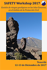 |
Workshop SAFETY Madrid 2017 Sentinel for geohazard prevention and Madrid, 29 de noviembre de 2017 [+ Información] | 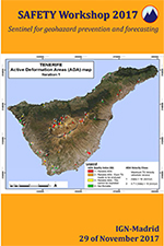 |
Worskhop M3EF3 2017 Workshop on Mechanisms, Monitoring and Modeling Alicante, 16 – 17 de noviembre de 2017 [+ Información] |  |
Workshop LASER 2017 Workshop on Land Subsidence Induced By Fluid Madrid, 14 de noviembre de 2017 [+ Información] |  |
Jornada DORIS 2013 DORIS: un servicio para la detección, Madrid, 3 de septiembre de 2013 [+ Información] |  |


